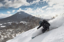
Hiking in Hokkaido is a must for anyone wanting to experience the islands outdoors at its best. With many great mountains and peaks to summit, the choices are seemingly endless. Often, trails will take you through dense forest, sometimes across moss covered creeks and if you’re lucky, to a waterfall or lake.
One mountain that draws locals and travellers alike to climb its meandering trails is Mt. Yotei, a Fuji-esque landmark on Japan’s 100 famous mountains list. There are 4 main trails divided into 10 sections with markers, which you can take to the summit of Yotei, much the same as Fuji, with their varying degrees in difficulty. Possibly the busiest (easy to understand as it’s considered the easiest) is the trail on the Makkari side, with its reasonably large camping grounds to be found as you approach the trail head. For the less serious hiker such as myself, this is the ideal way to go but kid yourself not, to reach the summit is no walk in the park.
You find some stark differences between hiking Yotei and Fuji as you reach some of the higher trail markers. Fuji for the most part is relentless, with a never letting up gradient that just reaches switchback after switchback. Yotei on the other hand, perhaps the gradient isn’t as extreme but some of those switchbacks require some reaching, grabbing and clambering to make your way up to the next section of trail.
The trail begins its steady ascent through the humid, fairly dense, forested area surrounding its base, with a sometimes slippery embankment to clamber up just to alert you of what’s to come. In comparison this is pretty different to the hike I experienced at Mt. Fuji, ascending the Gotemba trail, we were already above the tree line and the ground was mostly volcanic dirt/sand. After passing the first couple of trail markers things start to change, views begin to widen as you break through the treeline, the air slowly begins to cool and as you may have guessed the trail continues to wind on.
…on a clear day you can see for miles.
As you pass the upper trail markers, the view really starts to develop and on a clear day you can see for miles. You can opt to venture over to the mountain hut as you near the summit but as there is little to see, best to just reach the craters edge.
Once you have reached the craters edge you can see down into the crater and depending on the time of year, perhaps there may still be some snow melt left in the basin. If reaching the true peak is your aim then continue to head around the craters edge to the opposite side which is where you will find the peak and its marker. One of the views I enjoyed the most was looking back over Annupuri and the Kutchan area, it’s amazing how small it all looks from the top of Yotei.
For those seeking a more casual experience rather than a hike, it is possible to take an alternate route not too far along the trail at around 580m altitude that loops back around to the camping ground at the base. For those considering a shorter hike this is a great alternative route; just head around to the Niseko side and take the loop around Lake Hangetsu, which looks stunning – especially during autumn as the leaves change colour and fall from the trees.


